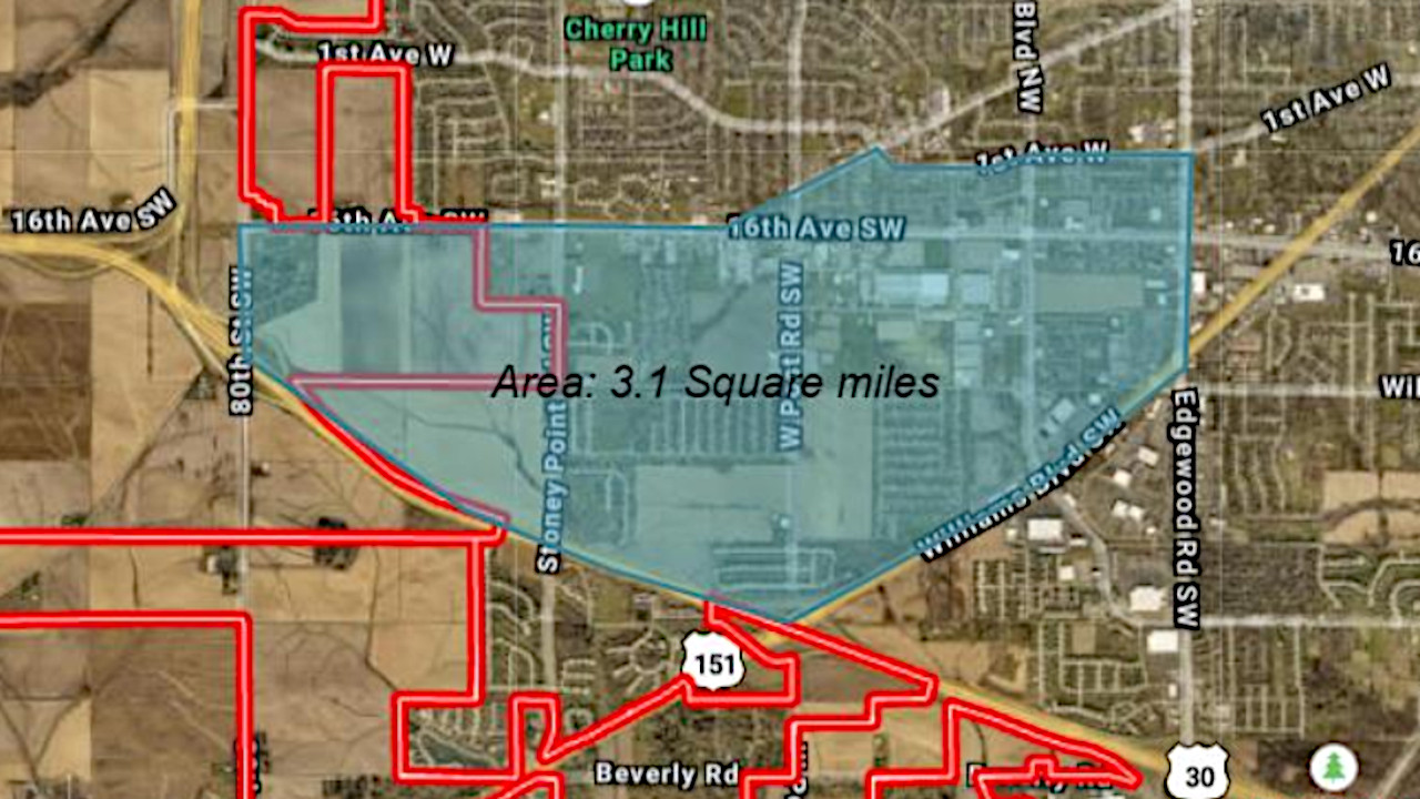
Cedar Rapids city leaders say the city council’s approval of a new action plan for the Westdale area of southwest Cedar Rapids this week will help perpetuate the area’s economic growth and ongoing recovery from the 2020 derecho. The action plan, approved by the council at their regular meeting Dec. 20, covers approximately three square […]
Already a subscriber? Log in
Want to Read More?
Get immediate, unlimited access to all subscriber content and much more.
Learn more in our subscriber FAQ.
- Unparalleled business coverage of the Iowa City / Cedar Rapids corridor.
- Immediate access to subscriber-only content on our website.
- 26 issues per year delivered digitally, in print or both.
- Support locally owned and operated journalism.
Do you want to read and share this article without a paywall?
Click here to purchase a paywall bypass linkCedar Rapids city leaders say the city council’s approval of a new action plan for the Westdale area of southwest Cedar Rapids this week will help perpetuate the area’s economic growth and ongoing recovery from the 2020 derecho.
The action plan, approved by the council at their regular meeting Dec. 20, covers approximately three square miles in the city’s southwest quadrant. The area is bordered approximately by 16th Avenue SW and First Avenue West to the north, Edgewood Road to the east, Williams Boulevard and Highway 30 to the south, and 80th Street SW to the west.
The action plan, to be incorporated into the city’s Envision CR long-term comprehensive development plan, has been in the works since last summer, city development planner Jeff Wozencraft told the council Dec. 20. It was initiated after city leaders recognized that the area sustained major damage in the August 2020 derecho. The area has also experienced “significant and rapid growth” in recent years and has large areas available for development, and its residents comprise a “diverse population with unique needs.”
The plan, designed to guide future development of the area, was developed in several phases, including an advisory group meeting, in-person walking audits of the area to ascertain needs and conditions of the area, and an open house for area residents in October to gather further input.
Several key needs emerged from the information-gathering process, Mr. Wozencraft said. The area lacks recreational opportunities and green space, walkability is an issue along Wilson Avenue and 16th Avenue SW, and the area’s diversity needs to be celebrated.
Areas cited for further development include connectivity, including improvements in walkability and accessibility as well as active transportation options, and land use and placemaking, including development of more recreational areas and green spaces and supporting existing and new neighborhood centers. The plan also advocates construction of a pedestrian path and a pedestrian crossing at Delaney Park, installation of public art projects to foster a “welcoming environment” and appointment of a task force to study tree-planting options in the area.
City council member Scott Olson, who lives near the Westdale action area, hailed the plan’s approval as a key step in future development, noting the Westdale area has been considered the city’s fastest-growing since 2010.
“We're seeing people compete to develop higher-quality projects in an area that was considered not ripe for development,” Mr. Olson said.
He also noted that many of the area’s most severely derecho-damaged structures have now been rebuilt and reoccupied, and ongoing projects in the area, including the new HIghway 100 extension, bring the promise of even more development to the area.
“Out of adversity comes opportunity,” he said. “This plan allows other developers from outside the community to (recognize) that there is a plan. They know where the trails are going and which roads are being improved. All of a sudden, properties become more valuable … it’s an exciting time to be in southwest Cedar Rapids and northwest Cedar Rapids, because finally, people are realizing this is an area to make things happen.”
Council member Dale Todd agreed, noting that the area saw a surge of affordable housing in the past without adequate infrastructure to support the growth.
“A lot of that housing needs to be replaced,” he said. It's old, and it's seen better days.”
He also noted that Delaney Park, historically underdeveloped, was established after the Cedar Rapids school district decided against building a new school in the area due to swampy land conditions.
“It's an interesting story, how a neighborhood develops around Delaney Park, and now it's become sort of the epicenter of a lot of activity,” he said. “Ultimately, you should have the park in the beginning instead of having to put it in after it's all developed.”